

Movement controls published for Al Qudra Road, Al Meydan Street and the Airport Tunnel
Dubai tightens truck traffic rules on major roads
The RTA and Dubai Police published curbs on heavy-vehicle movement across named Dubai corridors. Fleet managers serving airport cargo, catering and facilities contracts are the first group that has to re-plan.
Al Qudra Road Al Meydan Street Airport Tunnel
What was announced
Named corridors, not a single test zone
Dubai's Roads and Transport Authority and Dubai Police introduced truck movement restrictions across a set of Dubai roads. The stated aims are traffic flow and road safety, which is the standard framing for movement controls in the emirate. The restrictions cover several named corridors rather than one trial location, so dispatch teams should treat the announcement as a network-wide planning input rather than a local detour notice.
Where a rule names a road rather than a zone, the practical work moves from "which district" to "which link in the route". That shifts the question to corridor-by-corridor planning: who runs the road, at what hours, and what the closest alternative link looks like when the primary one is unavailable.
Planning checklist for fleets
- Confirm which of the named corridors your regular runs actually use.
- Check whether a permit, a time window or neither applies to each leg.
- Map one workable alternative link per corridor before the first affected shift.
- Brief drivers on the assumption that enforcement follows the published rule.
The roads affected
Three named places, three different jobs
-
Al Qudra Road
Outer arterial · southern and western crossings
Al Qudra Road carries traffic across the southern and western parts of the emirate, including routes that link development areas to the main network. Restrictions on an arterial of that kind push planners toward alternative corridors rather than a simple time shift. That is where route planning gets more involved: the honest answer for a long-haul leg is usually a different road, not an earlier departure.
-
Al Meydan Street
Inner-city street · dense mixed traffic
An inner-city street is a different problem from an arterial. Heavy vehicles here mix directly with passenger traffic at close spacing, and the conflict points sit at junctions and service entrances rather than at open interchanges. For operators, the useful check is whether a delivery address is reached from that street itself or from a side road that stays outside the restriction.
-
Airport Tunnel
Hub access · freight and service vehicles
The Airport Tunnel sits on routes serving Dubai International, which makes it a freight and service-vehicle corridor as well as a passenger one. Restricting truck movement through it changes timing for deliveries that connect to the airport area. Operators serving cargo, catering or facilities contracts will feel that first.
Why the Airport Tunnel matters to freight
The leg that feeds the country's busiest hub
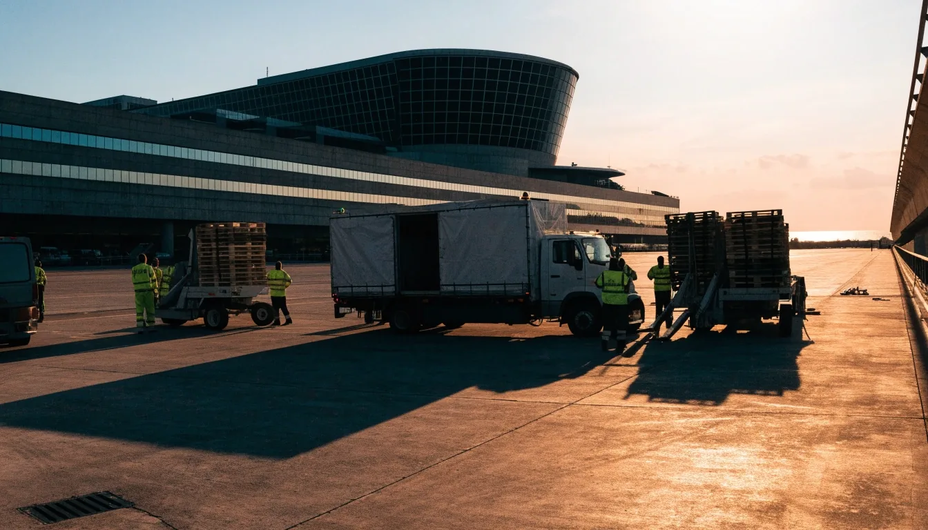
Truck movement through a tunnel feeding an airport is not the same kind of restriction as one on an open road. The tunnel carries a fixed volume of passenger vehicles toward terminals, and any heavy vehicle inside it consumes more of that capacity than it would on a surface carriageway. Restrictions here are therefore about protecting throughput at the hub, not about tidying a quiet stretch of road.
In planning terms, that pushes operators to answer two questions before the next shift: does the delivery genuinely need the tunnel, and if not, what is the realistic surface alternative and how much time does it add? Catering, cargo and facilities runs are often the ones with the least slack in their timetables, so they are the runs worth re-timing first.
What operators should check
Start from the named roads, not from a city-wide rule
For a fleet manager, the useful questions are which corridors are covered, what hours apply, and whether permits or alternative routes exist. Because the restriction list is specific, dispatch planning should start from the named roads rather than treating it as a general emirate-wide rule. A blanket assumption in either direction costs money: obeying a rule that does not apply wastes routes, and missing one that does apply strands a vehicle at the wrong end of a corridor.
Before the next dispatch
- Read the published restriction list against your own route file, link by link.
- Note the hours each corridor is affected, and whether they differ between roads.
- Ask whether your operation needs a permit, a window, or a different road entirely.
- Plan the alternative before the primary leg closes, not after a driver is turned back.
Where the uncertainty sits
- Which further corridors may be added once the first set is assessed.
- Whether exemptions exist for specific vehicle classes or contract types.
- How signs on the ground align with the published list at each junction.
- Whether marine crossings are covered by the same measure or a separate one.
We will update this report if the authority publishes further detail.
Enforcement and the safety logic
Truck movement controls follow the same logic as the road they sit on
The measure is framed around traffic flow and road safety, which means enforcement follows the same logic as the rule. Truck movement controls of this kind typically target peak congestion and conflict points where heavy vehicles mix with dense passenger traffic. That is consistent with the corridors named: an outer arterial, an inner street and a hub access tunnel each contains a different version of that conflict.
For drivers, the practical consequence is that an informal habit — taking a familiar truck route at a familiar hour — is the risk, not a deliberate violation. The cost lands on the operator who never checked the published list, so briefing drivers on the named corridors matters more than the wording of the announcement.
The rule, the signs and the patrol pattern are meant to carry one message.
Coverage state of this report
- Announcement detail Charted
- Permit rules Extending
- Marine crossings Uncharted
- On-ground signage Uncharted
We mark a row as charted only when the authority has published it, and we leave the gap visible rather than filling it with assumption.
Read our editorial standardsThe urban context
A network being made easier to read
Dubai has been revising how its road network is described and managed, including a new addressing system with colour-coded area identities and updated signage. Movement rules and addressing changes are separate programmes, but they share a purpose: making the network legible and predictable. Our Urban section covers the addressing side.
Both programmes land on the same group of people. A driver who has to relearn a street name and a dispatcher who has to relearn a permitted route are working from the same underlying change: the emirate wants the network described in a way that can be followed consistently, by residents and by freight operators alike.
Read the addressing rollout
How this fits our coverage
Road rules, enforcement and infrastructure
Transport & Urban collects road rules, enforcement and infrastructure changes across the Emirates. That includes movement controls on freight corridors, revisions to how the network is described, and the everyday enforcement detail that decides whether a published rule changes anything on the ground. Al Shandagha Tunnel and the marine crossings sit inside the same beat, and we treat them as separate questions from the corridors announced here until the authority says otherwise.
If a restriction is applied differently on the ground than in the announcement, tell the desk; that is a story we would report. Contact details are on the Contact page, and tips from drivers, dispatchers and site managers are the fastest route to a correction. Coverage of this topic continues as the authority publishes more, and the weekly briefing carries the summary each week.
Questions operators are asking
Which areas do the restrictions cover?
Announced areas include Al Qudra Road, Al Meydan Street and the Airport Tunnel, among others.
Why were the restrictions introduced?
The RTA and Dubai Police framed them around improving traffic flow and road safety.
What should a fleet manager do first?
Compare the published list against the routes you actually run, then check hours, permits and the nearest workable alternative for each named corridor. Starting from the roads rather than the city keeps the check small enough to finish before the next shift.
Does the change apply to marine crossings?
Marine crossings have been raised alongside the road corridors. We are treating them as a separate question until the authority sets out the detail, and we will say so plainly once it does.
Where do I report a difference on the ground?
Send it to the desk through the Contact page. Signs that contradict the published list, or a corridor where the rule is applied differently, are both worth reporting.
NavigationInf is an editorial newsroom covering roads, navigation, transport and urban infrastructure across the Emirates and the wider Gulf. Reach the desk at info@navigationinf.info or +971 4 391 2244, Monday to Friday, 9:00 AM – 6:00 PM. Office 402, Al Thuraya Tower 1, Dubai Media City, P.O. Box 500001, Dubai, UAE.